Plot Mapping
Surveying a piece of land using a UAV is known as drone mapping. Hundreds of photos are taken while the drone is flown over a piece of land by its operator. The photos are then stitched and layered together using computer software to produce a representation of the location.
Sector-Specific use of Drones
Land Mapping
Drones can now quickly and affordably survey enormous regions, and they can also give hard data that speeds up operations in a number of business contexts.
Aerial mapping is clearly beneficial to land surveyors. It is their responsibility to collect exact measurements of various parcels of property in order to establish borders. They use the information they gather to produce maps, plots, and legal documents. Without a doubt, drone photogrammetry may benefit their line of work as maps are such an important component. With photogrammetry, surveyors may acquire a very accurate map that is then quickly converted into a 3D topographic map with contour data—a procedure that used to be incredibly laborious. Surveyors can generate exceptionally precise maps for their clients thanks to their knowledge and the ownership of high-quality equipment like RTK GPS units, and the efficiency that drones offer enables them to speed up their workflow and increase their bottom line.
Create comprehensive 3D models and high-resolution orthomosaics of locations with poor quality, old, or even no data.
Surveyors are required by many sectors to create maps of land regions. Drone surveying makes the task simpler, faster, and safer for surveyors, enabling them to do everything from determine the general slope of an area to create comprehensive maps of every square foot. Some of the most notable businesses using drones for land mapping include: Construction, Oil and gas, Infrastructure, Mining, Archaeology.
Sector-Specific use of Drones
Archaeology
Enables the discovery and analysis of archaeological sites by archaeologists of diverse skills and locations.
In recent years, there has been an upsurge in the surveying, checking out, and mapping of archaeological sites using drones and drone cameras. Drone photography’s excellent resolution makes it possible for archaeologists of various experience levels and geographical areas to find and study ancient sites. It has never been simpler for archaeologists to identify specific features when utilising drone mapping software, to construct flight routes.
This is accomplished using a variety of methods, including fieldwalking and aerial photography. A group of individuals will go fieldwalking when they traverse an expanse of open ground they think may be of archaeological significance. A predetermined spacing between parallel lines is typically used for this. Drone use might revolutionise this method by enabling surveyors to create aerial images in advance of venturing outside in their muddy boots to look for potential areas of interest.
This would avoid field weariness, which, if you’re not cautious, might result in a failure to recognise specific traits. The University of Cambridge, which claimed that some of its academics are attempting to “combine machine learning with high-resolution drone footage” to maximise field survey techniques, has even corroborated this.
Inspections of wind turbines are benefiting greatly from drone technology.
Archaeologists must first inspect the region to see whether it appears to be a viable location before beginning any digging. They can accomplish this rapidly and cheaply by using drones, which also helps them to identify intriguing regions.
Benefits of Drone
Reduce field time and survey costs
Drones can collect topographic data up to five times more quickly and with less labour than traditional techniques. You may also save time using PPK geo-tagging as installing several GCPs is no longer essential. In the end, you deliver your survey data more quickly and for less money.
Provide accurate and exhaustive data
Only individual points are measured by total stations. A single drone flight generates hundreds of metrics that may be shown in several forms (orthomosaic, point cloud, DTM, DSM, contour lines, etc). Each point in the 3D model or pixel in the generated map comprises 3D geo-data.
Map otherwise inaccessible areas
Nearly anyplace may be used as a launchpad for an aerial mapping drone. No longer are you constrained by inaccessible regions, perilous steep slopes, or rough terrain unsuited for conventional measurement instruments. Roads and railroad tracks don’t have to be shut down. In reality, you may collect data while operations are running without incurring organisational costs.
- Minimal downtime of less than 45 minutes per turbine
- Quick data processing with strong back-end AI
- Reduction in operation costs
- Proactively maintain and increase revenue with longer uptime with predictive maintenance activities.
- Scan large areas in short time
- Inspection completed under normal operation, reducing downtime costs
- Drones can cut up to 50% from inspection costs compared to traditional techniques
- Regular inspections resolve issues while under warranty
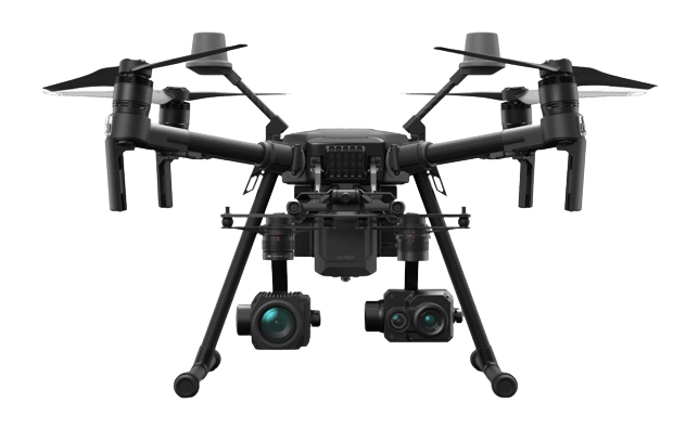
Package Dimensions
(790×390×290mm)
Dimensions (unfolded)
(887×880×378 mm)
Dimensions (folded)
(716×220×236 mm)
Folding Method
Folded Inward
Diagonal Wheelbase
25.3 inch (643 mm)
Number of Batteries
2
Weight
(with two standard batteries )
Max Takeoff Weight
6.14KG
Max Payload
Approx.2.3kg and 1.57kg (with two standard batteries )